


Australia, Tasmania, Frenchmans Cap National Park, 1961, 1:63 360
Copyright Expired
![]() Download (9.68 MB)
Download (9.68 MB)

| dc.coverage.spatial | Australia | |
|---|---|---|
| dc.coverage.spatial | Tasmania | |
| dc.coverage.spatial | Frenchmans Cap National Park | |
| dc.coverage.spatial | 1:63 360 | |
| dc.date.accessioned | 2020-05-13T05:10:58Z | |
| dc.date.available | 2020-05-13T04:57:45Z | |
| dc.identifier | 9819 | |
| dc.identifier.uri | http://hdl.handle.net/1885/204135 | |
| dc.format.extent | 10 MB | |
| dc.format.extent | 1 map | |
| dc.format.extent | 72 MB | |
| dc.format.extent | 1 map | |
| dc.format.extent | 300 dpi | |
| dc.format.mimetype | image/jpg | |
| dc.format.mimetype | image/tiff | |
| dc.language.iso | en | |
| dc.publisher | Mapping Branch, Land and Surveys Department, Hobart 1961 | |
| dc.relation.ispartofseries | 1 Inch to 1 Mile | |
| dc.rights | Copyright Expired | |
| dc.subject.other | Topography | |
| dc.subject.other | Australia -- Maps | |
| dc.title | Australia, Tasmania, Frenchmans Cap National Park, 1961, 1:63 360 | |
| dc.type | Cartographic material | |
| local.description.notes | Issued by authority of the Hon. D.A. Cashion, Minster for Lands and Works, Tasmania | |
| local.description.notes | Map Library Server, Asia Pacific Map Collection | |
| dc.date.issued | 1961 | |
| local.type.status | Published version | |
| dc.date.updated | 2020-05-13T04:57:45Z | |
| dc.provenance | Date Scanned: 21/03/2017 | |
| Collections | AUS07 - Tasmania | |
Download
| File | Description | Size | Format | Image |
|---|---|---|---|---|
| 9819_Australia_Tasmania_Frenchmans Cap National Park_63.36K__master.jpg | 9.68 MB | JPEG Image | 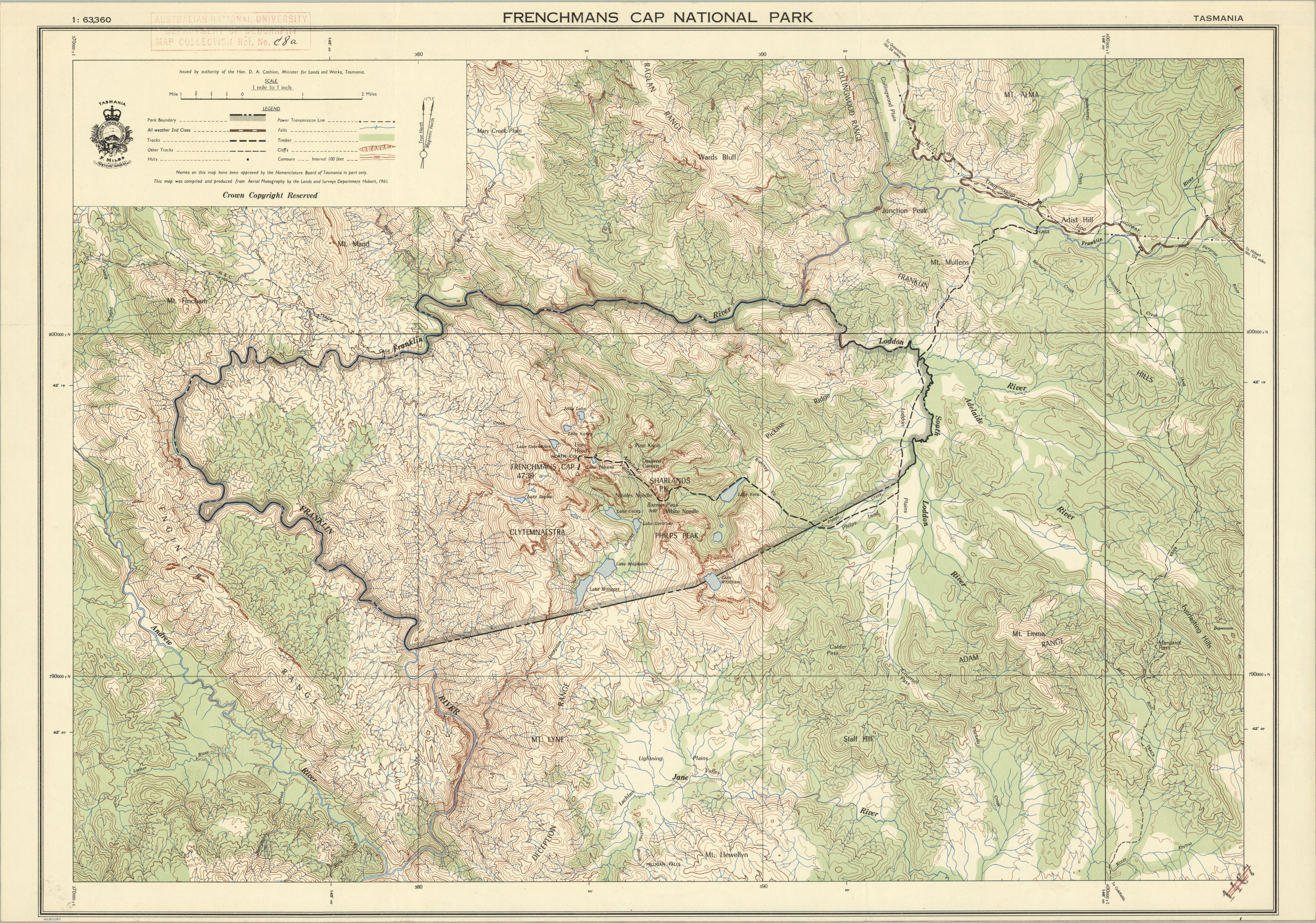 | |
| 9819_Australia_Tasmania_Frenchmans Cap National Park_63.36K__master.tif | Preservation copy | 86.91 MB | TIFF |  |
Items in Open Research are protected by copyright, with all rights reserved, unless otherwise indicated.
Updated: 17 November 2022/ Responsible Officer: University Librarian/ Page Contact: Library Systems & Web Coordinator
+61 2 6125 5111
The Australian National University, Canberra
CRICOS Provider : 00120C
ABN : 52 234 063 906


