


Solomon Islands, Malaita, Series: Sketch, Sheet INDEX, 1966-1967, 1:50 000


| dc.coverage.spatial | Solomon Islands | |
|---|---|---|
| dc.coverage.spatial | Malaita | |
| dc.coverage.spatial | 1:50 000 | |
| dc.date.accessioned | 2019-01-30T05:49:42Z | |
| dc.date.available | 2018-08-13T02:02:50Z | |
| dc.date.created | 1966-1967 | |
| dc.identifier | 2107 | |
| dc.identifier.uri | http://hdl.handle.net/1885/146243 | |
| dc.format.extent | 1 map | |
| dc.format.extent | 300 dpi | |
| dc.format.mimetype | image/tiff | |
| dc.language.iso | en | |
| dc.publisher | Great Britain: Directorate of Overseas Surveys | |
| dc.relation.ispartofseries | Sketch Series | |
| dc.relation.isversionof | 1 | |
| dc.rights | Copyright Expired | |
| dc.subject.other | Solomon Islands-- Maps | |
| dc.title | Solomon Islands, Malaita, Series: Sketch, Sheet INDEX, 1966-1967, 1:50 000 | |
| dc.type | Cartographic material | |
| local.description.notes | Drawn by Departments of Lands & Surveys and Geological Surveys | |
| local.description.notes | Misssing map 5 | |
| local.description.notes | Map Library Server, Asia Pacific Map Collection. | |
| local.type.status | Published Version | |
| dcterms.accessRights | Open Access | |
| dc.provenance | Date Scanned: 19/09/2011 | |
| local.identifier.sheetNumber | Index | |
| Collections | SLB03 - 1:50 000 | |
Download
| File | Description | Size | Format | Image |
|---|---|---|---|---|
| 2107_Solomon Islands_Malaita Index_50K__master.jpg | 7.28 MB | JPEG Image | 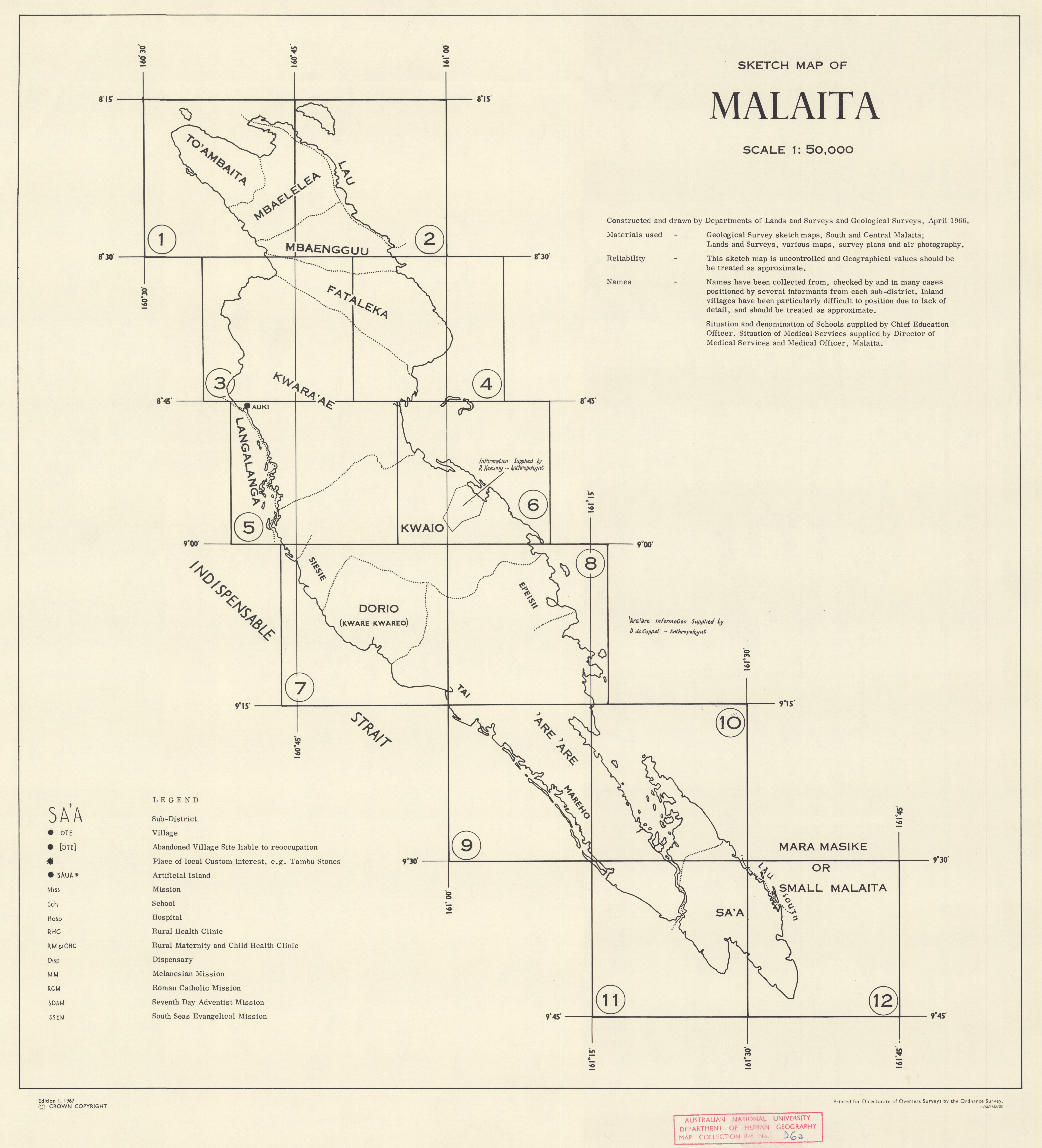 | |
| 2107_Solomon Island_Malaita Index_50K__master.tif | Preservation Copy - Index sheet | 127.3 MB | TIFF |  |
Items in Open Research are protected by copyright, with all rights reserved, unless otherwise indicated.
Updated: 17 November 2022/ Responsible Officer: University Librarian/ Page Contact: Library Systems & Web Coordinator
+61 2 6125 5111
The Australian National University, Canberra
CRICOS Provider : 00120C
ABN : 52 234 063 906


